Kings Park Bushland
Escape the urban jungle! Take a step into Kings Park’s bushland expanse and discover a wilderness that is dynamic and alive with the sounds, colours and activity of nature.
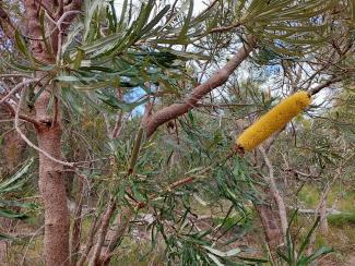
As you wander through the banksia woodland trails you will see unique Western Australian trees including tuart, jarrah and marri; banksias, sheoaks and other small trees and tall shrubs making up the overstorey; and low, beautifully flowering plants completing the scene in the understorey. Whether on two legs or two wheels, you’ll be immersed in scenic views and Western Australia’s famous wildflowers.
Why is the bushland so special?
- There are 327 species of local native plants growing in Kings Park bushland.
- 96 native bird species, 30 native reptile species, nine native mammal species and hundreds of different invertebrates, including ancient relic trapdoor spiders and the Bothriembryon snails, call the bushland home.
- If you look carefully you can spot 341 species of fungi and slime moulds amongst the wilderness.
What can I see in Kings Park bushland?
An incredible two thirds of Kings Park is protected as managed bushland. As you walk the trails, discover an insect-shaped orchid, a ghostly glow-in-the-dark fungus, a lizard camouflaged as bark, a close encounter with a nectar-feeding bird on a kangaroo paw, and the dramatic spring-time transformation of the grey-green bushland into expanses of colourful wildflowers. All point to the deeper secrets of a fascinating web of life held together by complex ecological interactions and intriguing adaptations to Perth’s harsh environment of infertile soils and hot, dry summers.

What are the bushland walking trails?
Different walking trails of Kings Park bushland offer unique experiences and levels of challenge. Law Walk and the Bushland Nature Trail are two trails that a must-see for any Kings Park visitor.
Law Walk
Distance: 2.5 km one-way
Time: Approximately 45 minutes
Difficulty: Moderate fitness required
Accessibility: Wheelchair and pram access is available on parts of Law Walk, from Swan Carpark (off Forrest Drive). A wheelchair turnaround bay is provided as the trail steepens just before Dryandra Lookout.
Law Walk is Kings Park's premier urban bushland trail that provides visitors with scenic views of the Swan River and a unique insight into biodiversity along the Mount Eliza escarpment.
Named after Robert Oswald Law, Law Walk begins at Karri Pavilion and continues along the ridge of the limestone escarpment to Dryandra Lookout. A loop walk is available here, and returns visitors to Karri Pavilion via the Lotterywest Federation Walkway.
Throughout the walk, visitors may observe flocks of birds panning out in flying formation over the Swan River, yachts moored at Matilda Bay, dolphins frolicking, Carnaby's black cockatoos feeding on marri trees or New Holland honeyeaters darting through parrot bush (Banksia sessilis).
Bushland Nature Trail
Distance: 1 km
Time: Approximately 25 minutes to complete
Difficulty: Easy
Accessibility: Suitable for most groups including families and people with disabilities
Did you know that there are more orchid species in Kings Park than the whole of Europe?
Western Australia is blessed with one of the most diverse and beautiful arrays of wildflowers in the world. The Bushland Nature Trail offers the chance to see wildflowers in their natural habitat with interesting signage along the way. Some of the beauties to discover within the bushland include seasonal Western Australian stunners such as jarrah, pixie mops, wild violets, grasstrees and kangaroo paws, as well as jug orchids, donkey orchids and spider orchids. Download our Pocket Guide for what’s in flower now!
Cycling and E-rideable paths
Whether riding to work or exercising on a weekend, it can’t get much more relaxing than riding through the lungs of Perth. Not all areas of the bushland are open to cyclists – refer to our Bushland Map for designated cycle paths.
We thank cyclists who comply with our Regulations to ensure all visitors have a positive and safe experience.

Protecting Kings Park bushland is an important task
Passing on this remnant jewel to future generations is of paramount importance, both for biodiversity conservation and for the wellbeing of the people of Perth and its many visitors. As the current custodians of this precious eco-sanctuary, the Botanic Gardens and Parks Authority, together with the community, is committed to conserving, enhancing, promoting and enjoying Kings Park bushland.
Learn more about bushland conservation and restoration in Kings Park and Bold Park.


")


